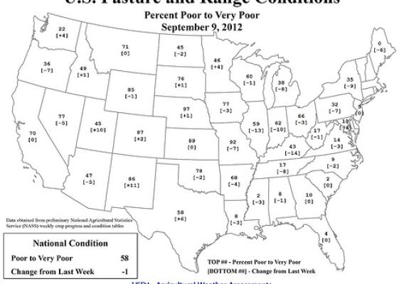
Visit www.usda.gov/drought for the latest information regarding USDA’s Drought Disaster response and assistance.
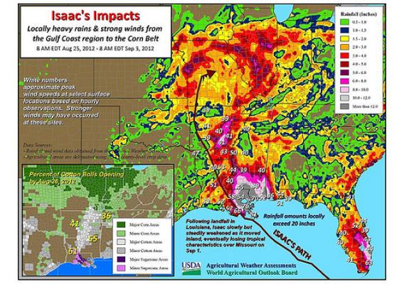
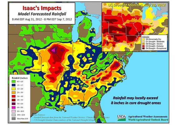
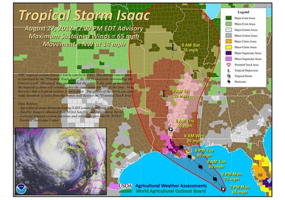
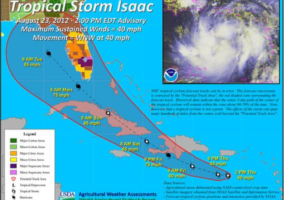
In recent days, some of the weather focus has shifted from drought to the tropics. Indeed, Tropical Storm Isaac is bearing down on the central Gulf Coast of the United States, and hurricane warnings have been issued from Morgan City, Louisiana, to Destin, Florida. According to the National Hurricane Center, a coastal storm surge of 6 to 12 feet can be expected in southeastern Louisiana and southern portions of Alabama and Mississippi, along and just east of Isaac’s expected path. On its present course, Isaac should reach the central Gulf Coast late Tuesday. The NHC indicates that further strengthening can be expected prior to landfall, and Isaac should reach the coast as a Category 1 hurricane – with sustained winds of 74 to 95 mph. Another threat related to Isaac will be flooding rains. Rainfall has already topped 10 inches in parts of southeastern Florida, where locally heavy squalls persist. In the central Gulf Coast region, widespread 6- to 12-inch totals are forecast, with isolated amounts near 18 inches possible. Crops potentially in the path of Isaac include cotton and sugarcane. By August 26, cotton bolls open in the Delta States ranged from 32% in Missouri to 61% in Louisiana. Cotton in the open-boll stage of development is especially vulnerable to damage when high winds and heavy rain occur. In Louisiana, more than one-quarter (28%) of the new sugarcane crop had been planted by August 19. Many other crops, including unharvested corn, rice, and soybeans, could be susceptible to lodging (i.e. being flattened or blown over) or quality degradation due to Isaac’s effects.