
wetlands

Conservation Groups, Farmers Protect & Restore Precious Puget Sound Estuary

When many people think of Washington State, they imagine rain, coffee and apples. My view is much more complex and nuanced, thanks to our team at NRCS who showed me diverse agricultural landscapes, including the state’s major estuary - Puget Sound.

During my visit, I was greeted by an idyllic landscape steeped in history. Early settlers to the Puget Sound area converted marshlands into pastures and hayfields. We visited one such area now known as Klingel Wetlands, where levee systems were installed in the 1890s and 1950s to prevent flooding.

At a Washington Ranch, It's for the Birds - and Elk

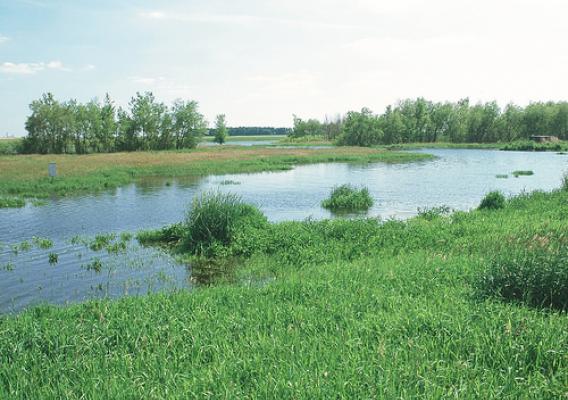
Most landowners would give up when faced with the challenges on Nine Pine Ranch near Chewelah, Washington, but not Glen Hafer. After trying for 40 years to farm his piece of land in the Colville River Valley, Hafer decided to convert it back to its original glory – wetlands.

Historically, the land in this valley flooded annually from the river, but settlers drained the area to farm. With no wetlands to hold water, flooding in the area worsened over time, making the land tough to farm.

When Hafer took the reins of his family’s land, he wanted to do something different. He was already – as he puts it – “semi-retired” and wanted to use his land to support his family.

Rocky Mountain Wetland Provides Fen-tastic Habitat for High Altitude Plants, Wildlife

Sloshing through a wet meadow in ankle deep water, I am surrounded by thick mats of sedges, rushes and some beautiful wildflowers. This saturated meadow lies in the shadows of the 13,000-foot Sheep Mountain peak near Trout Lake, Colorado. It is a scenic spot, rich in plant diversity, but also a unique habitat in Colorado.

I am visiting this lush, high-altitude wetland with the Grand Mesa Uncompahgre and Gunnison National Forests’ lead hydrologist, Gary Shellhorn who explains that this wet meadow is called a fen. Fens are peat-forming wetlands, created when wetland plants die leaving mats of dead and decaying plant matter. Fens are sustained by mineral-enriched groundwater, which is less acidic.  For this reason fens support a more diverse plant and animal community. In southern Colorado, it takes about 2,000 years to accumulate eight inches of peat at a fen. This suggests that most fens are 4,000 to 10,000 years old.

Conservation Work in Arkansas Makes Positive Impact Downstream

I recently toured several farms near Stuttgart, Ark. with U.S. Environmental Protection Agency’s acting Assistant Administrator for Water Nancy Stoner, state officials and conservationists. We met farmers working to clean and conserve water using conservation efforts, including the Mississippi River Basin Healthy Watersheds Initiative of USDA’s Natural Resources Conservation Service.

The tour provided me and my colleagues from Washington, D.C. and almost a dozen states an opportunity to see firsthand how voluntary, incentive-conservation practices are helping Arkansas farmers maintain productivity while protecting wildlife habitat and improving water quality and water use efficiency.

On Terry Dabbs’ Discovery Farm, we heard how the combination of conservation practices results in better water quality. As Dabbs said, if he is contributing to poor water quality downstream and in the Gulf of Mexico hypoxic zone, he wants to know about it and fix it.

Kentucky Youngster Sees Firsthand the Importance of Wetland Restoration

USDA’s Natural Resources Conservation Service (NRCS) helps private landowners return fields and pastures that were drained for agricultural use back to their natural state – wetlands. This is because of the value that wetlands provide: they filter and store water, they prevent floods and they provide vital homes to wildlife.

Mark Putman in Christian County, Ky. is seeing the benefits on land he enrolled into a conservation easement with NRCS. Thanks to the wetland restoration project, he and his 10-year-old cousin, A.J., have a great story to tell.

Putman owns and operates a guided and non-guided hunting operation, so restoring the land to attract more wildlife was important. He and his family also enjoy hunting deer, ducks and turkey.

Light Detection and Ranging Helps USDA Pinpoint and Protect Archaeological Mounds

Sometimes to stop soil erosion, prevent nutrient and sediment runoff and improve habitat, conservation work does disturb the ground. Because of this, USDA’s Natural Resources Conservation Service relies on its archaeologists on staff to review locations prior to implementing these conservation practices. As the cultural resources specialist for NRCS in Illinois, I’m never quite sure what will turn up in my daily work.

Field investigations by NRCS archaeologists are conducted to look for surface indications of cultural resources, such as historic farm remains, prehistoric artifacts and above-ground structures. I have had opportunities to visit about 2,000 archaeological sites and to record about 400 new sites on private working lands throughout the state.

Secretary's Column: Supporting Cutting Edge Conservation

This week, USDA and its partners launched a new conservation initiative, the Regional Conservation Partnership Program (RCPP), a program that goes beyond traditional government support for conservation and allows businesses and other for-profit partners to invest in regional conservation projects. RCPP takes conservation off the farm and out of the forest and moves it into the board room.

The RCPP will competitively award funds to conservation projects designed by local partners and specifically tailored to local needs. Eligible partners include private companies, universities, non-profit organizations, local and tribal governments and others joining with agricultural and conservation organizations and producers to invest money, manpower and materials to their proposed initiatives.

A Wetland Returns to its "Roots" Through a Conservation Easement

If the land floods more often than growing a crop, why not let it go back to what it wants to be – a wetland. That’s what happened on the Hoppe Heritage Farmstead in 2011. The Hoppe sisters owned cropland along the southern branch of the Kishwaukee River in DeKalb County, Ill. About half of the land would flood on a regular basis.

After several years of dealing with the floods, the sisters decided to do something about it. They sold the homestead to the DeKalb County Forest Preserve District, which preserves and restores landscapes and their plant and animal life.

Terry Hannan, the forest preserve’s superintendent, contacted USDA’s Natural Resources Conservation Service about a conservation easement as a possible opportunity to improve the land.

Restored Wetland Doubles as Outdoor Classroom for High School Students

A 53-acre conservation easement is an ideal environmental learning lab for students at Francis Hugh Wardlaw Academy in Johnston, South Carolina.  The land was once pastures for cattle, but now it’s a vibrant wetland just across the street from the high school.

The contractor hired to install the restoration work, Charles Kemp, was instrumental in involving the school’s students in creating and managing the wetland. “These students are exploring what a career in agriculture or environmental science would be like, and they love being outside and escaping the confines of the classroom,” Kemp said.

USDA’s Natural Resources Conservation Service provided technical and financial assistance to develop the restoration plan, and install the structures and earthwork to convert the wet pasture into a functioning wetland.

Partnerships and Volunteers Bring a Midwest Wetland to Life

Now, when you look at the Nygren Wetland Preserve in Illinois, a menagerie of wildlife can be seen –  ducks and geese paddling about, white pelicans lounging, otters swimming and a pair of sandhill cranes huddling in a nest. There was talk of the endangered blanding turtles living in the wetland, too. It’s a wonderful scene, but it was much different 14 years ago.

The land, located along Raccoon Creek at the confluence of the Rock and Pecatonica rivers, was once forests and crops. The Natural Land Institute purchased the land in 1999, and that’s when transformation began.