
wyoming

Digging Those Dinosaurs on National Forests, Grasslands

When most folks think about our grand and beautiful national forests they probably don’t conjure up images of a fearsome Tyrannosaurus rex munching on his morning prey or a gentle Brachiosaurus chewing enough leaves to nearly fell a small forest just to fill her vegetarian stomach.

But millions of years ago this was exactly what was happening on lands that today comprise national forests and grasslands like the Thunder Basin National Grassland.

Scientific Climate Info Now Available for Producers in the Northern Plains

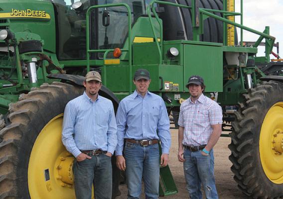
This fall, ranchers, farmers, and land managers in the Northern Plains from Bartlett, Nebraska to the Wind River Indian Reservation in Wyoming will be making decisions that will affect their operations in the coming year. Land managers often consider markets, weather and changing climatic conditions using data and information from various sources including newspapers and popular press publications, Cooperative Extension agents, State Climatologists, and the Internet.

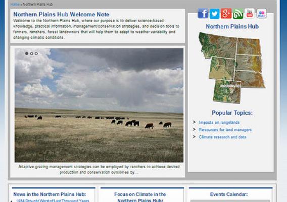
With the recent launch of the USDA Northern Plains Regional Climate Hub website, ranchers, farmers, and land managers have a new source for region-specific, science-based information, practical management and conservation strategies, and decision-support tools.  The national Hubs site features links to the latest climate news, events, thematic climate highlights (e.g. Croplands, Forestland, Grazing Lands and Livestock) as well as educational materials, factsheets, and regional contact information.

Wyoming Landowners Restore Riparian Areas in Big Horn Basin

It took Dee Hillberry six years before he could get a handle on encroaching and hardy invasive vegetation. Working on two separate properties, he removed tamarisk trees, or salt cedars, from 200 acres along Cottonwood Creek and Russian olive trees from 100 acres along the Big Horn River.

Despite Hillberry’s hard work in Hot Springs County, Wyoming, his efforts in restoring riparian areas were part of a larger endeavor that involved work done in phases over several years, over hundreds of miles, and with numerous partners in the Big Horn River basin. The basin is about 100 miles wide, and so far, more than 13,000 acres of invasive trees have been removed from the riparian area.

USDA Volunteers Receive Presidential Honor for Service

Two dedicated volunteers of USDA’s Natural Resources Conservation Service recently received the top honor for American volunteers – the lifetime Presidential Volunteer Service Award.

Russell Dorrough, of Texas, and Jerry Hattan, of Wyoming, have volunteered more than 4,000 hours with NRCS. Between 4,500 and 6,000 Americans receive this award each year.

The President’s Council on Service and Civic Participation created the President’s Volunteer Service Award program as a way to thank and honor Americans who, by their demonstrated commitment and example, give back and inspire others to engage in volunteer service. The lifetime award presented to Russell and Jerry is the program’s highest honor.

One Farm at a Time, USDA Helps Landowners Conserve Water in Ogallala Region

James Pike has tackled an important and thorny issue in Laramie County, Wyoming – water conservation. More specifically, this district conservationist with USDA’s Natural Resources Conservation Service (NRCS) has diligently worked to encourage farmers and ranchers in the region that is fed by the Ogallala Aquifer to use water wisely.

Stretching from western Texas to South Dakota, the Ogallala Aquifer supports nearly one-fifth of the wheat, corn, cotton and cattle produced in the United States. Underlying about 225,000 square miles of the Great Plains, water from the aquifer is vital to agricultural, cities and industry, making up 30 percent of all groundwater used for irrigation in America.

New Fences Keep Cattle In, But Allow Elk & Wildlife to Move Freely

Long-time rancher John Nunn’s land is near a route where pronghorn migrate. His ranch is surrounded by woven fences, and although the pronghorn can sometimes find a way through, he wanted to ease access for them.

 “We found they would go a certain path, and we didn’t want to jeopardize that,” Nunn said.

Conservation Easement Protects a Vital Stock Trail in Wyoming

Cattlemen, woolgrowers, anglers, hikers and hunters will continue to enjoy Beartrap Meadows in the Big Horns of Wyoming thanks to a conservation easement that will forever protect a stock trail used by many ranchers.

The project conserves part of a stock trail, or stock rest, in western Johnson County that has been used by agricultural producers for almost a century.

Located high in the southern Big Horn Mountains near the headwaters of Beartrap Creek, ranchers in the region rely on the area as a stopover for rest for their cattle and sheep while driving them to summer grazing pastures. More than 20,000 head of livestock travel the trail annually to take advantage of the area’s plentiful water and forage.

Final Yearly Snowpack Forecast Divides West into a Wet North and Dry South

Every winter Westerners look to the mountains and may not realize they’re peering into the future. More snow cap means more water come spring and summer. Many lives and livelihoods depend on nature’s uneven hand.

Thanks to USDA’s National Water and Climate Center, what used to be speculation is now science. Through a network of high-elevation weather stations across the West, the center accurately forecasts how much water Western states will receive from snowmelt.

The data benefits everyone in the path of the streamflow. The center’s water supply forecasts empower states to take action to prevent flooding or prepare for drought. Some farmers look to the water supply forecast when deciding what crops to grow. It’s like playing chess with nature, and you can almost see nature’s next move.

Wyoming Agriculture: Growing Opportunities

In May 2014, abundant snow and rain turned Wyoming pastures and crops green. In the same month, the 2012 Census of Agriculture showed that farmers and ranchers grew their opportunities from 2007 to 2012.

Wyoming is one of only 10 states that increased both the number of farms and ranches, up 6.1 percent, as well as the amount of land they operate, up 0.6 percent, between 2007 and 2012. Once again, Wyoming farmers and ranchers operated the largest farms and ranches in the U.S. with an average of 2,587 acres per farm compared with the U.S. average of 434 acres. Not only did the total number of farmers and ranchers increase, but the number of young farmers and ranchers increased, too. The number of Wyoming farmers and ranchers under the age of 35 increased by 17.4 from 2007-2012.

Western USDA Water Supply Forecast Tracks Melting Snowpack

April storms delivered a mix of rain and snow to the northern half of the West but didn’t provide much relief for the dry southern half, according to the latest USDA water supply forecast.

Washington, most of Idaho, Montana, Wyoming, and the northern parts of Colorado and Utah, are expected to have near normal or above normal water supplies, according to the forecasts from the Natural Resources Conservation Service’s National Water and Climate Center (NWCC).  Streamflows that are far below normal are forecast for the southern parts of Oregon and Utah, southwestern Idaho, California, Arizona, New Mexico and western Nevada.