If you live in the western United States and you’re sipping a glass of water, irrigating your crops, lighting your home with hydrological-sourced energy, or enjoy skiing or fishing, you’re probably using information made available from USDA’s snow survey program.
Snow provides 50 to 80 percent of the western water supply and while many agencies, utilities, Tribes and others have a role in snow surveys, USDA’s Natural Resources Conservation Service (NRCS) leads efforts to make sure all the players use accurate and consistent methods and come home safely. NRCS just released its February forecast.
Thus, each January, NRCS hosts a West-wide Snow Survey School for one week. This year was California’s turn — and the school was held at Granlibakken outside of Tahoe City.

Fifty-five students attended including representatives from all 12 of the Western states that participate in snow survey, according to Tony Toldsdorf, school coordinator and hydrologist from the NRCS National Water and Climate Center in Portland. Participants also came from six different federal and state agencies and utilities. Participants learned everything from proper snow measurement, to avalanche recognition, snowmobile basics, an abundance of survival tactics, and much more.
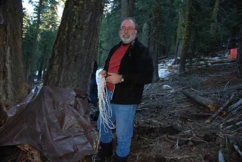
One of the more challenging and intriguing requirements of the course is to build an overnight shelter and spend the night in it. Typically that means a snow cave, but for the second time in as many California rotations, Tahoe City had only icy patches of scattered snow so students scoured a wooded mountain slope for materials and sites to build — or dig — their shelter.
Instructors stressed the importance of finding a flat spot and that seemed to be among the top criteria students used to assess their options, but there were other criteria as well. “I looked for something soft and dry — and out of the wind.” said Dave Kreft of NRCS in Washington State looking up from his tarp that covered a pad that in turn covered pine boughs.
Deprived of snow, the students built creative shelters using logs, evergreen boughs, tarps, ski poles — or in some cases, excavated small earthen trenches. “The main point is to build their confidence,” said instructor Scott Pattee of Washington State. “They need to know if the unexpected happens and something goes wrong, they have the skills they need to survive outdoors and they don’t panic. Then you can act more clearly.”
Several of the participants agreed that an added measure of confidence was exactly what they got from the bivouac experience.
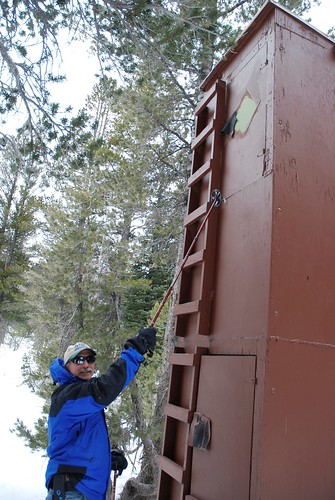
While there are 853 automated SNOTEL collection sites across the West, manual surveys still collect measurements in some areas and ground truth the automated data. The final day of the course was devoted to the techniques of this manual measurement. “You’re most likely to remember the last thing you learn so we save the best for last,” Pattee said with a chuckle.
While the patches of snow were icy and meager at Granlibakken where half of the students practiced measuring methods, the snow at Mt. Rose a half hour drive into Nevada proved more plentiful — though still far below past snowfall levels. Participants worked in teams of two — one measuring and the other recording.
At the end of the week, participants and instructors alike felt the school was a success. “This class was really engaged and very creative with the small amount of snow we had,” said Toldsdorf. “I’m confident participants have the skills and capacity they need — and we need — to keep collecting snow data for western water forecasting.”