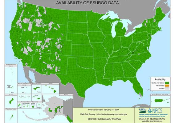
Soil scientists from across the southeastern region of the U.S. came together recently to celebrate the completion of Georgia’s soil survey. With this mapping complete, very few areas of the nation’s soils in the 48 contiguous states are not recorded.
USDA’s Natural Resources Conservation Service (NRCS) mapped soils information for Georgia’s 159 counties. The map data can be accessed online through NRCS’ Web Soil Survey.
Soil surveys involve studying the nature and properties of soils, mapping their location on the landscape and interpreting their unique sets of characteristics. The information found in these soil surveys was used by producers to better understand their soils, and how best to use and protect them.