
snow survey

A Walk in the Woods and Never be "The Marching Man"

On a sunny January morning in 2010, Tony Tolsdorf had no idea that a walk in the woods would become the longest night of his life.

“It was really warm that morning, probably 55 or 60 degrees,” he recalls. “It was one of those days where you just have to get outside and do something, so I went for a hike in the Columbia River Gorge.”

His plan was to hike on a creek side trail for about seven miles, then climb onto a ridge and hike back toward his car.

Where Passion Meets Purpose: The Snow Survey

“To say I enjoy my job is an understatement,” said Hydrologist Randy Julander. “Monday is my favorite day of the week, because I get to go back to work.”

As the Snow Survey Data Collection Officer in Utah, Julander’s job is a mix of science, adventure and artistry. He weaves information from data. “Data are just numbers on a page; but information - now that’s something meaningful, something that informs decision makers,” he explained.

Interactive Map Compares Past and Present Snowpack - Western Snowpack Levels Very Low

Western snowpack, where it remains, is in full melt.

All along the Cascades and Sierra Nevada are ski courses that never opened, bare mountains and snowless SNOTEL sites where snowpack is measured. Where snow accumulated, it melted prematurely during a warm March. One of the most common questions for snow surveyors has been: how does this winter compare to the past?

A new, interactive map shows you exactly how it compares. The online map, just released by the USDA’s Natural Resources Conservation Service, shows regularly updated current conditions - alongside historical records - for the entire NRCS snow survey network.

In the West, Preparing for Uncertain Water Supply

“Well, this shouldn’t take long,” Dr. David Garen said as I sat down to interview him about April snowpack conditions. “March was warm and dry. Spring came early and the snowpack is already melting across most of the West. The End.”

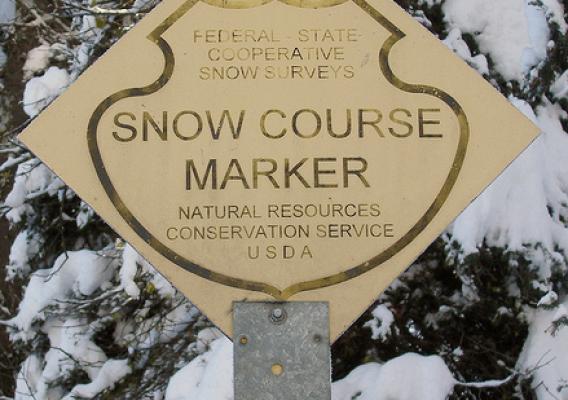
Garen is a hydrologist with the USDA’s Natural Resources Conservation Service. Among other duties, he creates forecast maps and helps write the West-wide forecast summary for the Snow Survey Program.

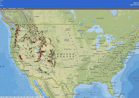
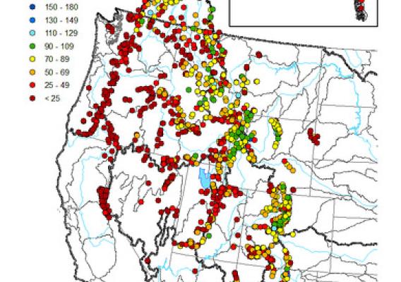
“This year we had record low snowpack up and down the West Coast,” said Garen. “But even in the areas that had normal snowpack, it’s melting earlier than usual.” Historically, April 1st is when the snowpack peaks. This year has been different.

How USDA's Snow Survey Program Got Started

James E. Church was a man who answered his calling. Like a real-life Indiana Jones, Professor Church pursued adventure around the world, ending a war and helping to found the Snow Survey Program on the way. Every hero needs a cause; Church found his in snow.

Born in Michigan in 1869, Church moved west in 1901 to teach classics and art history at the University of Nevada, Reno. The nearby Sierra Nevada fascinated him. He hiked there often, publishing his mountaineering accounts in the Sierra Club newsletter.

Surveyors Learn to Measure Snow, Prepare for Risks in Remote Mountains

If you live in the western United States and you’re sipping a glass of water, irrigating your crops, lighting your home with hydrological-sourced energy, or enjoy skiing or fishing, you’re probably using information made available from USDA’s snow survey program.

Snow provides 50 to 80 percent of the western water supply and while many agencies, utilities, Tribes and others have a role in snow surveys, USDA’s Natural Resources Conservation Service (NRCS) leads efforts to make sure all the players use accurate and consistent methods and come home safely. NRCS just released its February forecast.

Western USDA Water Supply Forecast Tracks Melting Snowpack

April storms delivered a mix of rain and snow to the northern half of the West but didn’t provide much relief for the dry southern half, according to the latest USDA water supply forecast.

Washington, most of Idaho, Montana, Wyoming, and the northern parts of Colorado and Utah, are expected to have near normal or above normal water supplies, according to the forecasts from the Natural Resources Conservation Service’s National Water and Climate Center (NWCC).  Streamflows that are far below normal are forecast for the southern parts of Oregon and Utah, southwestern Idaho, California, Arizona, New Mexico and western Nevada.

Year's First National Water Forecast Predicts Limited Supply West of the Continental Divide

A limited water supply is predicted west of the Continental Divide, according to the Natural Resources Conservation Service (NRCS) National Water and Climate Center (NWCC) data in its first forecast in 2014.

The NWCC also predicts normal water supply east of the Continental Divide and will continue to monitor, forecast and update water supplies for the next six months.

Monitoring snowpack of 13 western states, the center’s mission is to help the West prepare for spring and summer snowmelt and streamflow by providing periodic forecasts. It’s a tool for farmers, ranchers, water managers, communities and recreational users to make informed, science-based decisions about future water availability.

NRCS Snow Surveyor Collects Vital Water Data, Lives Dream Job

Koeberle’s job carries her over mountains by helicopter and horse, snowshoes and skis. She has encountered grizzly bears, avalanches and wolves and visited ridges that few people have seen.

Koeberle is a hydrologist and snow surveyor for USDA’s Natural Resources Conservation Service (NRCS) and works on the agency’s snow survey team—a group of specially trained scientists who maintain snow gauges that are important to farmers, business owners and many other people in the West.