

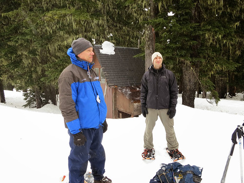
A stormy February doubled the Mount Hood snowpack from five feet to ten – a relief for northern Oregon, which has been unseasonably dry. Hydrologists have told me about dramatic recoveries, but this is the first time I’ve witnessed it.
I recently joined Julie Koeberle, one of our hydrologists with USDA’s Natural Resources Conservation Service, to collect data that would be released in the March forecast from the agency’s National Water and Climate Center.
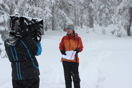
We snow-shoed out to the site and weighed the snow, and a local reporter tagged along to see how it’s done. Weighing snow allows surveyors to calculate the snow-water equivalent, in other words, how much water is in the snow. Light, fluffy snow contains less than dense, packed snow.
When Julie finished measuring and calculating, she spoke on camera about conditions in Oregon. With her strong South Carolina accent, bright outfits and snow-covered pigtails, Julie is a novelty in the program. I often hear good-natured remarks on the irony of this charming Southerner telling Oregonians how much water they should expect.
This month the news is good. Though many areas are still behind, February storms have helped large parts of the West.
Like Julie, I grew up in the South. Three inches of snow shut down cities. To me it meant no school and maybe sledding on the nearby hill. In the West, snow means something else entirely.
Out here, most of the water arrives as snowfall. The mountain snowpacks are frozen reservoirs that slowly melt during spring and summer. Everything is affected by the snow.

Utilities depend on snowmelt for water and hydroelectric power. Reservoir operators manage their water volume based on anticipated snowmelt. Farmers and ranchers depend on it to water their fields and livestock. Recreation depends on snow – winter sports, as well as rafting and fishing later in the year. Westerners know the value of snow. They watch their snowpacks with keen interest.
That’s where Julie and other snow surveyors come in. Since 1939, NRCS has been measuring snow to forecast water supply.
The modern Snow Survey and Water Supply Forecasting program operated by the National Water and Climate Center depends on a network of automated weather stations, known as snow telemetry, or SNOTEL sites. These sites are spread across mountains of the West.
SNOTEL sites take hourly measurements of local conditions – precipitation, snow depth, snow water content – and send that data to regional base stations where NRCS hydrologists can access it. Sometimes hydrologists, manually measure snow near SNOTEL sites for a “ground truth,” confirming the site is reporting accurately.
By comparing current conditions to past years, hydrologists accurately forecast the volume of streamflow from snowmelt. This information is invaluable and can be accessed via our Snow Survey page.
I’m grateful for the hard work of Julie and the other NRCS snow surveyors and hope to get to join them again on their important forecasting mission.
