

Communities across the United States are facing water challenges, impacting millions of lives and costing billions of dollars in damages. Recent events, including record-breaking drought in the West and severe flooding in the Southeast have elevated a national dialogue on the state of our Nation’s water resources and infrastructure.
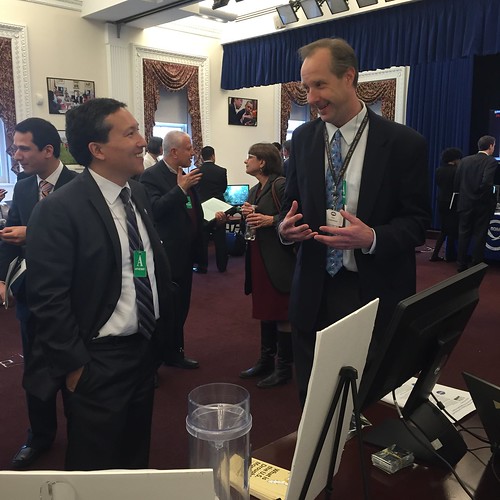
These challenges are why on March 22, the White House hosted a Water Summit to correspond with the United Nations World Water Day. The meeting raised awareness of water issues and highlighted potential solutions to building a sustainable and secure water future. Following a slate of presentations outlining innovative solutions to water quality and quantity challenges, attendees were invited to review interactive demonstrations of projects including technologies that help communities and businesses manage the challenges of long term drought.
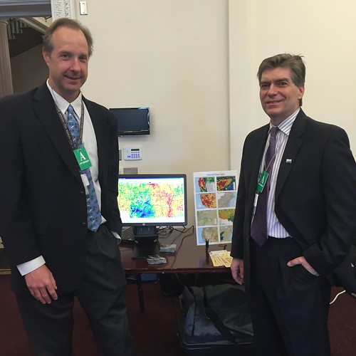
Eric Luebehusen, agricultural meteorologist for USDA’s Office of Chief Economist and World Agricultural Outlook Board, gave a live demonstration of the making of the United States Drought Monitor (USDM). The USDM is a groundbreaking product that has been used by the Department as a trigger mechanism for providing billions of dollars in USDA emergency aid to farmers and ranchers. As one of two USDA authors of the USDM, Luebehusen highlighted the various types of data used by the authors and the partnerships that have developed across the Federal government through the years to strengthen this unique tool. He also provided insight into the substantial role that USDA played in migrating the USDM from a hand-drawn map, to one based in a state-of-the- art Geographical Information System (GIS).
Participants saw detailed assessments of the drought in their home states as Luebehusen explained the data products that best describe the current level of drought in their particular locales. For example, in California, USDM authors use snowpack measurements and reservoir levels to accurately track drought. In other regions, different measurements like 3-month rainfall accumulation, might be provide a more accurate depiction of drought conditions.
“I was very pleased with the amount of interest and interaction our US Drought Monitor display generated,” said Luebehusen. “We actually had folks from multiple states come up to our display and comment on the current drought depiction, with some going so far as to offer some feedback and suggestions for this week’s map!”
“I concur with Eric’s sense of pride with USDA’s role in shaping the Drought Monitor over the years. Several of the attendees expressed their gratitude that we take the time to produce such an important product. The Department itself shows its confidence in the product by using it as a trigger mechanism for multi-billion dollar programs,” said Mark Brusberg, Deputy Chief Meteorologist in USDA’s Office of Chief Economist.
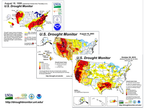
Since the inception of the USDM in the late 1990s, the USDA Drought Monitor Team has been at the forefront of data acquisition, building partnerships with providers of information to both ensure the sustainability of necessary products and facilitate creation of new types of information useful to the drought communities. Several of these partnerships were on display at the USDA booth, including the Community Collaborative Rain, Hail, and Snow (CoCoRaHS) Network, an example of effective data collection by citizen scientists through a coordinated volunteer network.
“At the USDA, we take a great deal of pride in our contributions to the Drought Monitor, not only from an authoring perspective, but also from a developmental perspective, spearheading the effort to get the Drought Monitor based on a much more dynamic Geographic Information System Platform,” said Luebehusen.
The United States Drought Monitor is just one of the important ways USDA uses state of the art data and research to support communities facing water quantity and quality challenges due to changing climate and extreme weather. The White House Water Summit served as an important platform to highlight the ongoing work of the federal family in bringing modern solutions to water challenges now and into the future.